 |
| Oct 2012 |
Shortly after coming out from CP6, we hit the road where we were able to catch night view of the city.
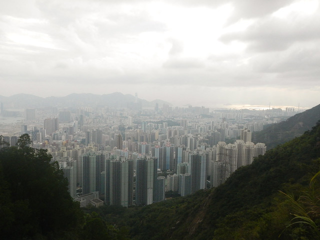 |
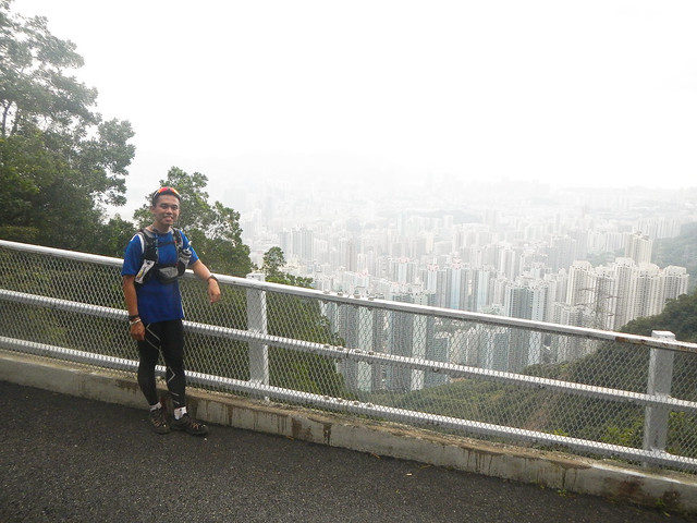
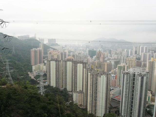
| Oct 2012 |
Daytime view.
The view from here at night was simply fantastic.
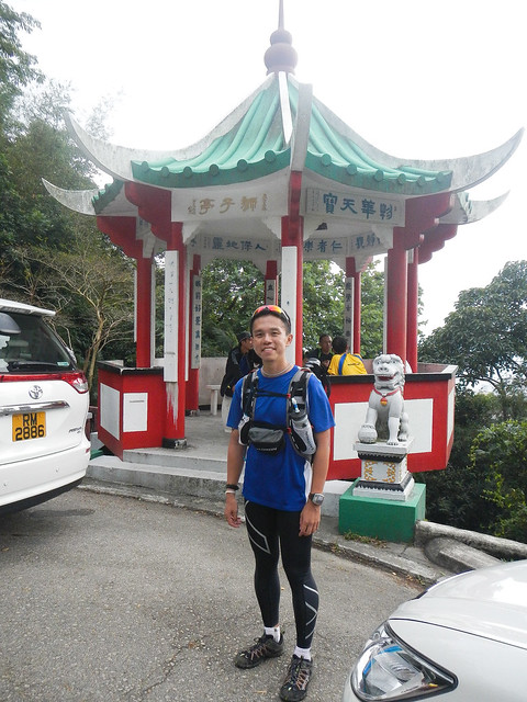 |
| Oct 2012 |
We passed by the Lion's Pavilion (狮子亭) which was also at the place where Bernie introduced me to the tasty 豆腐花. Too bad it was midnight and the shop was closed.
We continued down the road until we came to a staircase which went up to Lion's Hill (狮子山). We would not go up Lion's Hill but go straight to Beacon Hill (笔架山)
I met Pei Sunn and Alber here. Alber was accompanying Pei Sunn who came back to take the bronze trophy. Alber and I chatted for a while. He told me he had also done the Raleigh Challenge at Wilson Trail in October 2012. He said the terrain at Wilson Trail was much tougher than Maclehose Trail. I could not imagine how tough it could be.
CP7 Beacon Hill (笔架山)
Distance: 73km
Time: 16:02:59

My impression of CP7 was that it was decorated by a lot of cyalume sticks and bands, starting from a distance leading towards the CP. Certainly gave a welcoming feeling to me.
The next CP was 10km away. I still roughly recognised the route. We would follow the trail until we came to Tai Po Road. That would be the end of the route which Bernie brought me to run last October. For the route further on, Jennifer had brought me for a test run last February. I still remembered the hills vividly. I overtook Terence, Janelle and Osbert as I descended Beacon Hill and continued my power hike. To me, it was some sort of familiar terrain. I knew what was coming up next.
I arrived at Tai Po Road not long after. We had to use the overhead bridge a short distance down the road instead of jaywalking. :p
We cut into Golden Hill Road. We were entering the area with several reservoirs. I remembered as I was walking along, I observed the person some 30 - 40m ahead of me was not walking straight but in a diagonal manner. He would go to the edge of the road, hit the edge, continue ahead for a few steps before walking diagonally again in a zig zag manner. I looked for a while longer until I realised that he was sleep walking. Fortunately, there were no cars on the road. This was also the area where there were a lot of monkeys. So many of them that sometimes when they come out of the vegetation and stay on the road, the whole road would be blocked. Hundreds of them. Apparently, the government was too late in controlling their numbers and they has overpopulated. Luckily, there were none tonight. Or at least when I was passing through.
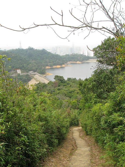
 |
| Feb 2012 |
We passed by this on the way to CP8. The night view was very beautiful.
CP8 Shing Mun Dam (城门水塘)
Distance: 83km
Time: 18:12:48
 |
| Feb 2012 |
Shing Mun Dam.

17km to go. Three hills.
Here we go.
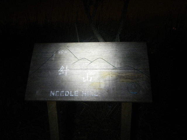
Running in the night could be very beautiful at times, when you see the trail of headlights dotting the way in front and behind you. In another way, the sight could be frightening too. Here we were, just about to leave CP8, on our right in a short distance away, we could see the dark silhouette of a conical hill against the night sky and a stream of headlights moving up. That .. would be the highest peak of Needle Hill.
 |
| Feb 2012 |
Going up the steps of Needle Hill. Its famous for its many many steps.
 |
| Feb 2012 |
Shing Mun Dam in the background,
 |
| Feb 2012 |
The highest peak (532m) of Needle Hill in the background. You could see the steps leading up.
The tip was covered by fog back then.
 |
| Feb 2012 |
Day time view.
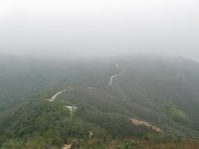
The route after Needle Hill heading to Grassy Hill. It was on asphalt road but it did not make it any easier.
I knew what was coming ahead since I had gone through this stretch before so I just trod along. Besides looking at where I am stepping, my sight were fixed on the moving headlights ahead of me.
When we reached Grassy Hill, we had to go down a steep and long flight of steps (descending 200m in elevation!) before reaching CP9. My legs were hurting like hell from all the continuous pounding. My foot trembled with each downward step I took. I could see the CP just at the valley below. There was another stream of headlights moving upslope away from the CP. That's Tai Mo Shan.
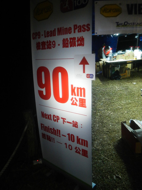
CP9 Leadmine Pass (铅矿坳)
Distance: 90km
Time: 20:18:02
一鼓作气.
Lets go!
Tai Mo Shan was the highest hill in Hong Kong. It was a long steep climb up. At some stretch of Tai Mo Shan, the path was not clear. It was just a pile of rocks on the ground. You could see the next route marker flipping in the strong wind, reflecting your headlight a distance ahead. You knew you had to go that direction to reach the route marker, you just had to figure out by yourself how to get across the rocks. The next runner was a distance in front of me. I tried to take note of the way he took so I could follow. Sometime I could not notice so I had to manoeuve over the rocks myself. The fog was getting thicker as we got higher and higher until I had to switch my headlight to full power. At some locations, I would look back and look at the trail of headlights behind me and tell myself "Wow! You were there a moment ago. Now keep moving!"
We came to a point where the trail ended and we moved onto the asphalt road. However, we were still going upslope! The fog was really thick so we could not really see far ahead. I was slowly walking up together with another local. It was his first time coming up to Tai Mo Shan.
We just need to get to the weather station at the top of the hill. We may not be able to see it clearly in the fog but passing it meant the remaining stretch would be downslope. Luckily, there was not much fog surrounding the weather station. As I started going downslope, I slowly broke into a slow run. I was surprised I could still run at this moment. The finish line was just 5km away and its all downslope!
The way down was winding. We turned corners after corners. Gradually I got low enough for the fog to disperse. The view was clearer now. It was near dawn now. There were some locals who had hiked up the opposite direction for their morning exercise. I kept asking them how far ahead was the Rotary Club Park where the finish line was located. Soon there were volunteers cheering for us. It must be just in front. When I could see the finish line, I joyfully sprinted towards it.
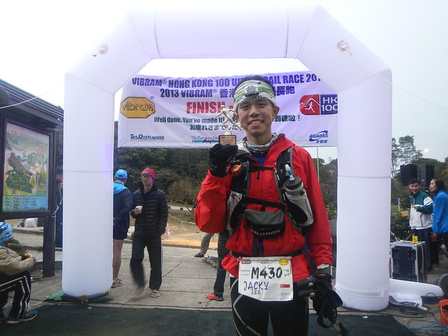
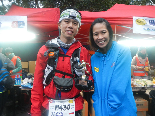
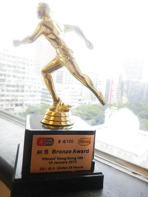
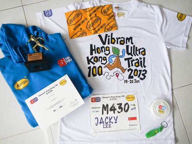
Net Time: 22:42:34
I came in before 24hrs so got myself a bronze trophy!
Yippee!!

Lesson learnt from HK100:
- I need to relook at my nutrition strategy. I seems to be having too much different types of stuff to eat. Some are distance based. Some are time based. When there is too much of both mixed together it becomes messy. I may need to remove the Anti-Fatigue pills and the Endurolyte.
- Bread may not be suitable as a solid food in cold weather races. It turns cold and is not really appetising.
- I stayed longer than I needed at the CPs causing my body to start cooling down.
- Learn to relax when going downslope. When you are feeling relaxed, its easier to go downslope. Its easier to "dance" on the trails.
No comments:
Post a Comment